Posts

Showing posts from 2023

Travel and Tourism - Scotland Unit

Image
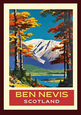
  Using AI ideas included  Exciting news! New entire revised and updated Scotland Unit for National Travel and Tourism in a 28 page PDF file that you can pick activities from - including attached Sways. It is engaging and colourful with fun activities to meet the outcomes, along with lots of exemplars and guidance. “Outlander” and “Dark Tourism” are used as trends that students immediately find interesting, as well as activities about pushing products on social media. They are also encouraged to set up their own agency and promote it using social media. Students are asked to think about interior design in holiday rentals and the use that AI can be in that design. In addition, they can start to think about their own wellbeing with simple changes they can make to be more “coorie”. The resource also includes access to two free Sway presentations. One provides exemplars for helping with mapping, the use of AI in designing, and understanding marketing in hospitality. The other allows the co

Using AI to create geographical images

Image
Just discovered a brilliant AI tool on @Canva. Opens up endless opportunities for resource creation, digital learning and student engagement. Called "Text to Image" it creates images from your descriptions. This short film shows what it can do.

Hydrosphere all in one place!

Image
 Looking for resources that cover the Global Hydrological Cycle, River Basins/Drainage Basins, Hydrographs, GIS and virtual fieldwork all in one place? If so, the link below is just what you are after! Hydrosphere - Part 1 (office.com)

SQA Exam Timetable 2024

Image
 Here we go again! Click on this link to access the exam timetable for 2024 from the SQA. NQ exam timetable 2024 (sqa.org.uk)

Hot desert survival challenge

Image
Engage you students by challenging them to survive whilst becoming lost in a hot desert. Firstly they can do some research for the task by accessing relevant film clips and information using a free Sway included as part of this resource. Students then make up a hot desert survival kit with a partner or group. This survival kit is then tested by way of hot desert survival scenarios. This is great fun and gets very competitive when used in the classroom and prizes can be offered… Students love it! A consolidation task is provided at the end to make use of the knowledge gained. The resource is bright and colourful. It is aimed at 10 to 14 year olds but to be honest, it can be used with any age group. This resource bundle consists of a 5 page PDF and a free information Sway. Find out more here:- Hot desert survival scenarios challenge | Teaching Resources (tes.com)

Experiencing the edge of a tornado in Poland

Ever wondered what it is actually like to experience a tornado? Not really something on most people's bucket list. However, as a geographer I have always been curious. Thankfully I have never experienced the full horror, destruction and heartbreak of a tornado, and it must be so terrifying for those who have. However, on a trip to Poland, quite unexpectedly, I did experience what it is like to be on the edge of one. I know, you are probably saying to yourself - do you get tornadoes in Poland? The answer most emphatically is yes! In fact, south central Poland is often described as Europe's tornado alley although we are only talking about 1 or 2 experienced on average over a decade. However, with climate change will the occurrence of these killers increase? Anyway, speculation aside, this film clip is my experience and it was wild! It hit rapidly. You could see it weaving through the baroque old town buildings of Krakow with terrifying speed. Trees snapped over before my eyes and

School Microclimate Study for Geography Fieldwork

Image
Geography assignments are back in the Scottish curriculum for National and Higher. How can you do fieldwork with a large class and very little equipment? What work do your students need to do to be successful with this? How can you fit in carrying out fieldwork as well as trying to complete the rest of the curriculum? Here is the answer! Carry out a microclimate study around your own school. This booklet contains everything you need to do this. It has clear instructions, templates for measuring, sketching and analysing results. It also gives ideas on how to process data gathered and write a conclusion. This booklet is also of use to any geography teacher worldwide looking for easy to arrange but very enjoyable fieldwork for their classes. Click on this link to find out more. School Microclimate Project

UK and Worldwide - Travel and Tourism Resource.

Image
Interested in an entire UK and Worldwide Unit for National Travel and Tourism? Elements of it are also suitable for BTEC Travel and Tourism with long haul destinations such as the Maldives and travel to the Arctic included. Related issues and solutions are explored with excellent examples and links.This unit is engaging, colourful with fun activities to meet the outcomes with lots of exemplars and guidance. Activities include carrying out a travel survey, designing an all-inclusive resort, planning an interrail trip and investigating ecotourism in the Arctic. The resource also includes access to a free Sway presentation to allow the completion of positives and negatives of tourism in the Maldives as a case study, including links to relevant websites and film clips. All outcomes are comprehensively covered. This booklet is flexible. Material can be used in format presented or activities can be extracted or uploaded onto Teams/OneNote for digital use. Required outcomes are clearly set ou

River Landscapes for all Learners

Image
  As a geography teacher, you will absolutely not escape teaching river landscapes to at least one year group - but realistically probably more than one year group. That's great as it is a superb landscape feature to introduce students to. Let's face it, most of them will have some prior knowledge of rivers, but to help them understand and know the features they can see will stay with them for a lifetime. We are all familiar with the bog standard features and diagrams associated with teaching this topic. As ever, diagram drawing and coloured pencils are essential. However, for younger students, getting to grips with sequencing diagrams can embed understanding for more complex river feature studies in later years. This link is an entire sequencing resource aimed at doing this in a fun, colourful and accessible way. Bumper Fun Rivers Sequencing Geography Colouring Book!  For your senior classes, this bundle consisting of a PowerPoint which builds understanding of entire river lan

Intertropical Convergence Zone

Image
Okay, how many of you have looked at the atmosphere unit that you are expected to teach in geography and thought to yourself - how can I deliver this in a way that the teenagers in front of me are going to be able to understand? For many years I bashed away at this and I think I eventually found the way forward. Firstly - humour. Make it feel like you understand as much as they do and give it a "lets all learn together" vibe. A bit of play acting comes in here. Secondly - humour! Lets all have a laugh together as we learn. Get everyone involved with leading questions but make the atmosphere (LOL) as if they are not being judged to encourage them. Thirdly - humour and colouring in. It's geography you are teaching! Don't forget the diagram drawing and colouring in. I usually joke that I keep the best coloured pencils just for that particular class as they are special (spoiler alert - I don't). Fourthly - here is my bit by bit lesson on the intertropical convergence

Pre-Flight Safety Briefing Simulation

Image
If you are delivering a Travel and Tourism course, it is often difficult to enrich delivery with work related practical simulations. This 10 page work booklet and associated Sway attempts to address this! Included is a detailed presentation of what is included in a pre-flight safety briefing to be delivered by cabin crew, engaging activities and everything you need to set up a simulation in your classroom. Help with how to assess this activity is provided also. Spice up your Travel and Tourism course and have fun with this. It will also help you greatly with how to deliver the outcomes required for the SQA Employability unit in Scotland without having to organise complicated work experience. Click on these links to find out more! Travel and Tourism - Pre-flight safety simulation activity | Teaching Resources (tes.com) Pre-flight safety briefing Aviation regulations state that the operators of aircraft must make sure that all passengers are orally briefed on safety before take-off. This

Students! All you need to know about your SQA Exams 2023

Image
 Exams can be really daunting. It would therefore be a good idea to check out this link to find help for any questions or worries you might have. Your Exams 2023 - SQA

What are 15 Minute Cities?

Image
15 minute cities! This is a red hot topic and is a MUST for any urban unit at Level 3, GCSE, National 4/5, Higher Geography, A Level and beyond. Resources are sparse on this extremely topical subject - so this bundle is a must! It includes a 12 page PDF file full of colourful information and engaging activities including making your own 15 minute city neighourhood, being a protestor and putting together a front page spread on the issues. Oxford and Paris are used as case studies but there are many opportunities to look into local examples. The PDF also includes access to a free Sway which guides students through the issues with pointers to relevant information and film clips. Relevant vocational links are also highlighted to help with positive destinations. Scan the QR code to find out more or click on this link. 15 Minute Cities  

How to make a climate graph on Excel

Image
 Want to boost your student's digital skills in an enjoyable and relevant way? This 6 page booklet shows them how to make a climate graph using Excel. The instructions are an easy to follow, step by step guide on how to do this. Boost your classes digital knowledge and help your students become confident with Excel and all it can offer. Find this resource by clicking this link. How to make a climate graph on Excel.